En
Menu
English
Arabic
Brazil
French
German
Italian
Russian
Simplified China
Traditional China
Spanish
Turkey
India
Vietnam
Japanese
Korean
Menu
By countries
By cities
Catalog
Maps
Maps
By countries
By cities
Contacts
About app
Wallet
Rewards
En
English
Arabic
Brazil
French
German
Italian
Russian
Simplified China
Traditional China
Spanish
Turkey
India
Vietnam
Japanese
Korean
Home
Maps
Sudan
Omdurman
Sections
Top places
Entertainment
Cinema
Library
Nightclub
Park
Stadium
Theatre
Attractions
Attraction
Church
Memorial
Monument
Mosque
Museum
Viewpoint
Business
Car Parts
Company Office
Lodging
Apartments
Camping
Guesthouse
Hostel
Hotel
Shops
Bakery
Bookstore
Butcher's
Clothes shop
Computer Store
Kiosk
Marketplace
Petshop
Supermarket
Health
Clinic
Dentist
Hospital
Pharmacy
Food
Cafe
Fast Food
Pub
Restaurant
Education
College
Kindergarten
School
University
Transport
Airport
Bus station
Gas station
Parking
Finance
ATM
Bank
ATM
بنك فيصل الإسلامية السوداني
2.5
Sudanese Egyptian Bank
2.5
Airport
Wadi Seidna Air Base
2.0
Apartments
غزالي عباس
2.5
Tilmawi
2.5
Attraction
4611686023150753606
2.5
الحارة 72
2.5
Bakery
Osama Bakery
1.5
Ainy Ala Sayga Bakery
2.0
Bank
Export Development Bank
2.0
Sudanese Islamic Bank
2.5
Bookstore
الثورة 7
2.5
Bus station
Bus to meroe pyramid
2.5
محطة كهرباء الحلفايا
2.5
Butcher's
AlShami
0.5
Althiqa Butcher
1.5
Cafe
Muzn Beach
1.0
Adoriz cafe
1.5
Camping
هشام
0.5
منزل صلاح ابراهيم مصطفي و اولاده
2.0
Car Parts
Surya Trading Ent
Omdurman, Khartoum State, Sudan, GPS: 15.648477,32.492027
Church
Nouba church
1.0
Cinema
Banat Cinema
2.5
Cinema Watania
1.5
Clinic
Al Mutakamil Clinic
2.5
مركز بلسم الصحي
2.0
Clothes shop
Mina Faiz Shop
1.0
Lovely
2.5
College
الكلية الحربية السودانية
2.5
Evinglical School
2.0
Company Office
Marwaco Commercial Enterprise
1.5
Health Caare Pharma Limited
1.5
Computer Store
Yaslem For Technology Engineering & Trading Co Ltd
1.5
Dentist
Alroomi Medical Center
Sudan, GPS: 15.691332,32.47641
Fast Food
King Al-Mango
1.5
Taza
1.0
Gas station
Petronas
2.5
Petro Nas
2.5
Guesthouse
مجمع البشير لسكن الضباط
2.5
بيت خالد عادل
2.5
Hospital
Dayat Labour Hospital الدايات
2.5
بحري
2.5
Hostel
بيت سيد أحمد
2.0
Hotel
Marfa Hotel
2.5
Rumah Duktur Fadwa
2.5
Kindergarten
Squire 1 Kindergarden
2.0
Kiosk
Bookshop
1.5
Bookshop
2.0
Library
Omdurman Central Library
0.5
Marketplace
سوق الفور
2.5
سوق مدني
1.5
Memorial
منزل المرحوم عثمان محمد حضرة
1.5
Monument
Tomb of "Mahdi"
1.0
Mosque
Mosque
2.5
Mosque
2.5
Museum
Khalifa Museum
1.5
مسجد الحيف
2.0
Nightclub
Omdurman Indian Club
2.0
Credit Cards
Outdoor Seating
Menus
+
more
Omdurman Indian Club
2.9
Al-Masalma, Omdurman, Omdurman, Khartoum State, Sudan, GPS: 15.66619,32.48175
Credit Cards
Outdoor Seating
Menus
+
more
Park
Safia Park
1.5
Mugran Family Park
2.0
Parking
Muzan Parking
1.0
Petshop
Camel market
0.5
Pharmacy
صيدلية علياء
2.5
صيدلية شهد
2.5
Pub
عبدالحليم
1.5
Restaurant
Debonairs Pizza (Bahri)
3.8
pizza $
Azhari Rd, Khartoum North (Al-Sha'abiya St.), Khartoum North, Khartoum State, Sudan, GPS: 15.641547,32.51946
Price
Reservations
Credit Cards
Outdoor Seating
+
more
Alhoush
3.8
$$
Omdurman , molazmeen (Almorada), Omdurman, Khartoum State, Sudan, GPS: 15.633073,32.493454
Price
Reservations
Credit Cards
Outdoor Seating
Music
Menus
+
more
School
Boys Secondary School
2.5
Secodary Girls School
2.5
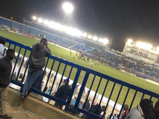
Stadium
استاد الهلال
2.0
AL-HILAL Stadium (إستاد الهلال)
3.2
العرضه شمال, Omdurman, Khartoum State, Sudan, GPS: 15.6472645,32.474506
Supermarket
Souq Libya (سوق ليبيا)
3.0
Sudan, GPS: 15.647743,32.424614
Credit Cards
+
more
الاحسان - بحري
3.5
Sudan, GPS: 15.641893,32.522057
Credit Cards
+
more
Theatre
Omdurman Radio , TV
Sudan, GPS: 15.6351385,32.49508
Khider Bashier Theatre
2.5
University
جامعة العلوم والتقانة
2.0
جامعة امدرمان الاهلية
2.0
Viewpoint
مسجد الفتح مربع 7
2.5
الجزيرة إسلانج
2.5
Show on map
Show list
MAPS.ME
is always on hand
Download the apps and start expanding your horizons
Open Maps.me app
Use web version